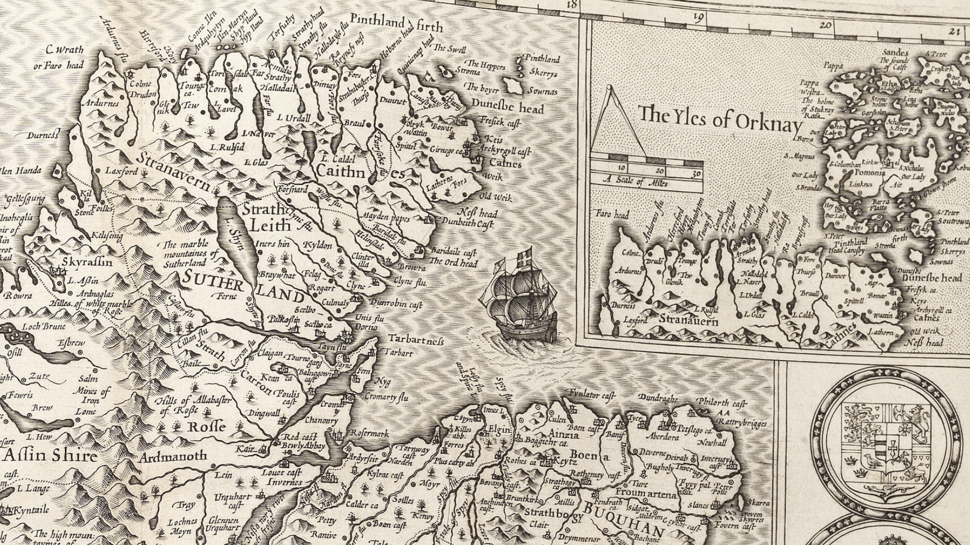
Tucked away in the Highlands, just off the A96 and a few miles in from the Moray Firth, you’ll find Caledonian Maps – a business known globally as the foremost specialist in historical maps of Scotland. Its range of maps will take you on an adventure dating back to 1610, but the company is also dedicated to the development of new maps using modern technologies.
Its archives include a rare atlas of Scotland dated 1912 (these are not copies, they are the originals published by Edinburgh Geographical Society), Town Plans from 1746 to 1825, Thomson Scottish Maps, Large Scale Counties to 1817, Victorian Ordnance Survey and so much more. On its website, you can search by place or type and if it happens you can’t find what you’re looking for, Caledonian Maps may be able to source it for you.
“We are passionate about maps,” states Caledonian Maps. “We love maps! We read old books about the origin of cartograpghy and about the first maps created covering Scotland. Drop by and have a cup of tea if you are passing by, but give us a quick call beforehand to check we are in.”