
A hand-coloured chart published nearly two centuries ago attempted to place Scotland’s great rivers side by side. The Tay still stands at the head of the country, but closer examination reveals altered waterfalls, engineered channels, shifting measurements and a landscape now facing pressures its makers could scarcely have imagined.
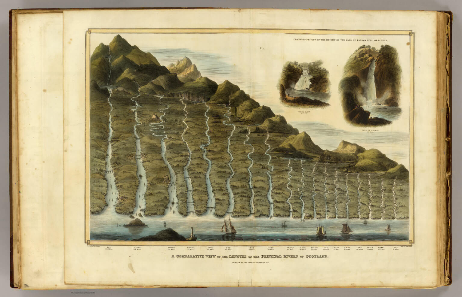
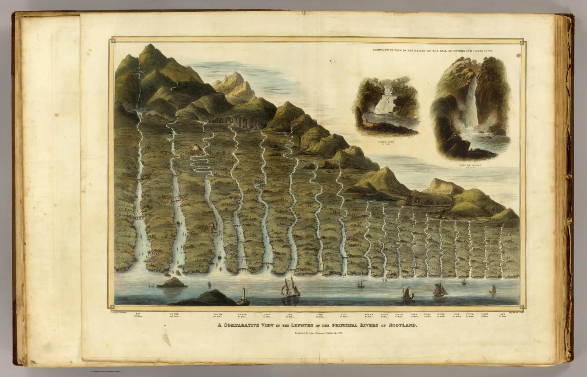
At first sight, the image resembles an impossible Scottish landscape: a single mountainous wall descending towards the sea, cut through by a procession of rivers and watched by sailing vessels waiting at their mouths.
It is not a conventional map. It is an early geographical infographic.
The plate is titled A Comparative View Of The Lengths Of The Principal Rivers Of Scotland. It was drawn and engraved by the Edinburgh artist, printmaker and mapmaker William Home Lizars, and published by the cartographer John Thomson.
The plate itself is dated 1831 and was issued in Thomson’s Atlas of Scotland in 1832. The original was a hand-coloured engraving measuring approximately 65 centimetres across.
The rivers have been lifted out of their true geographical positions and rearranged as parallel streams, generally from longest to shortest. Mountains, bridges, settlements and ships give the comparison the appearance of a landscape, but the scene never existed anywhere outside the engraver’s imagination.
Two smaller illustrations in the upper-right corner compare the Falls of Foyers, beside Loch Ness, with Corra Linn at the Falls of Clyde.
These were not incidental decorations. Both waterfalls were celebrated destinations in the early nineteenth century, when dramatic Scottish scenery had become a subject of tourism, art and romantic literature.
The Rivers In The Picture
The engraving names 18 rivers and gives their supposed lengths in miles.
| River | Length Shown In 1831 |
|---|---|
| Tay | 110 miles |
| Clyde | 100 miles |
| Forth | 90 miles |
| Tweed | 85 miles |
| Spey | 85 miles |
| Dee | 80 miles |
| Don | 60 miles |
| Nith | 60 miles |
| Annan | 40 miles |
| South Esk | 40 miles |
| Teviot | 35 miles |
| Isla | 35 miles |
| Earn | 35 miles |
| North Esk | 30 miles |
| Esk | 30 miles |
| Teith | 30 miles |
| Garry | 25 miles |
| Ayr | 25 miles |
These labels can still be read on high-resolution versions of the engraving preserved in public collections.
The list is revealing because it is not a modern scientific ranking of separate river basins. It places major rivers beside tributaries. The Teviot flows into the Tweed; the Isla and Earn join the Tay; the Teith enters the Forth; and the Garry belongs to the wider Tay system.
“Principal” was therefore an editorial judgement. The selection reflected reputation, regional importance, scenic interest and the information available to the atlas makers. It was not produced by a national hydrological database, chiefly because no such thing existed.
Several substantial rivers are absent, including the Findhorn, Deveron, Beauly, Ness and Lochy. Their omission does not mean they were unknown. It shows that even an apparently objective diagram carries the priorities of the person who made it.
Did The Rivers Become Longer?
Modern measurements do not agree neatly with Thomson and Lizars.
| River | 1831 Chart | Common Modern Measurement |
|---|---|---|
| Tay | 110 miles | About 117–120 miles |
| Clyde | 100 miles | About 106 miles |
| Spey | 85 miles | About 105 miles |
| Tweed | 85 miles | About 97–100 miles |
| Dee | 80 miles | About 88 miles |
| Don | 60 miles | About 84 miles |
| Forth | 90 miles | About 29 miles for the river proper |
The Tay is still accepted as Scotland’s longest river system. Tay Rivers gives its length as 117 miles, while other modern references measure approximately 120 miles depending upon the headwater selected.
The Clyde River Foundation records the Clyde at approximately 170 kilometres, or about 106 miles. NatureScot describes the Spey’s main river as approximately 170 kilometres, while the River Tweed is now commonly measured at between 97 and 100 miles.
The Dee’s main stem is generally measured at approximately 141 kilometres, or 88 miles, while the River Don is commonly recorded at about 135 kilometres.
That does not mean the Spey physically gained 20 miles or that nineteenth-century surveyors misplaced a quarter of the Don.
Why river lengths differ: a river’s reported length depends upon which headwater is selected, where the river is considered to end and how closely the measurement follows every bend and meander.
A measurement made from a small-scale printed map will smooth away minor bends that become visible through modern Ordnance Survey mapping, aerial photography and digital geographical systems.
The Forth provides the clearest warning against treating river length as a perfectly fixed fact.
The 1831 engraving assigns it 90 miles. The modern River Forth proper is commonly described as approximately 29 miles long, while other organisations use longer figures depending upon whether upper tributaries or sections of the tidal estuary are included.
The old figure probably followed the water from an upper source through the tidal Forth and towards the open sea. Modern figures commonly distinguish the river from the estuary.
That is an interpretation, but it explains the discrepancy far better than the proposition that 60 miles of the Forth have somehow gone missing.
The Rivers Have Physically Changed
The numbers may be slippery, but the physical changes are real.
Rivers naturally move. Banks erode, gravel shifts, islands form, meanders migrate and floods can cut new channels.
Human beings have added dredging, straightening, embankments, weirs, dams, culverts, bridges, reservoirs, industrial abstraction and flood defences.
No river in the engraving demonstrates that more clearly than the Clyde.
The Clyde shown by Lizars was already becoming an industrial waterway, but the great transformation was still under way. From the late eighteenth century, the Clyde Navigation Trust oversaw improvements intended to make the river suitable for increasingly large commercial vessels.
Dredging, quay construction and alterations to the channel helped transform a difficult, shallow river into one of the world’s great industrial waterways.
Glasgow Museums describes this as two centuries in which the river made Glasgow and Glasgow remade the river.
A Glasgow archive plan from 1839 (only eight years after the engraving) shows proposals for dredging, removing a weir, constructing wharves and even cutting a canal across a bend near Little Govan.
The Clyde was not merely being mapped. It was being redesigned.
The same pattern occurred on smaller rivers throughout Scotland. SEPA records that agricultural, forestry and urban development resulted in straightening, dredging, channelisation, culverting and damage to riverbanks.
Artificial barriers interrupted fish movement, while abstraction and flow regulation altered the amount and timing of water passing downstream.
The modern policy direction is increasingly to reverse some of that work. Scotland’s river basin management programme includes projects to restore urban rivers, improve habitats and remove or ease artificial barriers where practicable.
It is a curious historical turn: earlier generations spent substantial sums forcing rivers into obedient channels; the present generation is spending money attempting to give some of their movement back.
The Two Waterfalls Were Transformed
The most dramatic changes in the engraving may not involve the rivers’ lengths at all.
The Falls of Foyers are shown as a great natural cascade dropping through a rocky Highland gorge.
In 1896, water from the area was harnessed to power an aluminium smelter, creating what SSE describes as the first hydroelectric-powered aluminium works in Britain.
Loch Mhor was dammed to provide storage, and the site was later redeveloped as a pumped-storage power station, officially opened in 1975.
Water is now moved between Loch Mhor and Loch Ness through tunnels and shafts, allowing the station to generate electricity rapidly when demand rises.
The waterfall still exists, but it is no longer governed solely by rainfall, rock and gravity.
Corra Linn has also become part of an engineered energy landscape. The hydroelectric scheme at the Falls of Clyde diverts and regulates water from the river.
The Scottish Wildlife Trust warns visitors that levels can change quickly because of power-station operations.
The natural spectacle celebrated in the engraving is therefore still visible, but the amount of water passing over it can be influenced by machinery and electricity demand.
The two picturesque insets have acquired a second meaning. They no longer show only natural wonders. They mark two places where Scotland’s falling water became industrial power.
A Different Kind Of Change
The mapmakers of 1831 were concerned principally with distance, elevation and spectacle. The modern questions are increasingly about ecological condition, temperature, flooding and whether rivers have enough space to behave like rivers.
The Scottish Government’s flood-resilience work estimates that peak river flows could increase substantially by the end of the century.
Its national strategy says the number of Scottish properties exposed to flooding could rise from about 284,000 to almost 400,000 by the 2080s.
Warmer water and periods of low flow also threaten fish. Adaptation Scotland identifies rising river temperatures and reduced water levels as dangers to fish health, while riparian woodland is increasingly being planted to provide shade, stabilise banks and improve habitat.
The River Spey remains one of Scotland’s most important natural rivers, supporting Atlantic salmon, lamprey, otter and freshwater pearl mussel.
Yet even there, environmental bodies have identified pressures from water abstraction, forestry, barriers and physical modification.
The river’s outline on a map may appear timeless, but the conditions within it are not.
What The Engraving Really Measures
The chart is not a reliable modern table of river lengths. It is something more interesting.
It records the moment when Scotland’s rivers were being converted from local knowledge into national data, just as industrial society was preparing to alter them on an unprecedented scale.
The Tay remains longest. The Clyde, Spey, Tweed and Dee remain among the country’s defining waterways. The smaller names of Teviot, Isla, Earn, Teith and Garry, still bind their landscapes together.
Sources
David Rumsey Historical Map Collection — A Comparative View Of The Lengths Of The Principal Rivers Of Scotland
https://www.davidrumsey.com/luna/servlet/detail/RUMSEY~8~1~35301~1180926%3ALength%2C-rivers-of-Scotland-
Wikimedia Commons — High-Resolution Public-Domain Reproduction
https://commons.wikimedia.org/wiki/File:1822_-_William_Home_Lizars_-_Comparative_View_of_the_Lengths_of_the_Principal_Rivers_of_Scotland.jpg
SEPA — River Basin Management Plan For Scotland 2021–2027
https://www.sepa.org.uk/media/594088/211222-final-rbmp3-scotland.pdf
Scottish Government — National Flood Resilience Strategy
https://www.gov.scot/publications/national-flood-resilience-strategy/
Glasgow Museums — River Clyde Transport And Technology Collection
https://www.glasgowlife.org.uk/media/1666/collection-summary-transport-and-technology.pdf
Glasgow City Archives — River Clyde Improvement Plan
https://cityarchives.glasgowlife.org.uk/Record.aspx?id=D%2FTC%2F13%2F266&src=CalmView.Catalog
SSE Renewables — Foyers Hydro Scheme
https://www.sserenewables.com/hydro/foyers/
Scottish Wildlife Trust — Visiting The Falls Of Clyde
https://scottishwildlifetrust.org.uk/2021/03/five-things-to-know-when-visiting-the-falls-of-clyde/
NatureScot — River Spey Designation And Environmental Condition
https://www.nature.scot/sites/default/files/site-special-scientific-interest/1699/sssi-citation.pdf