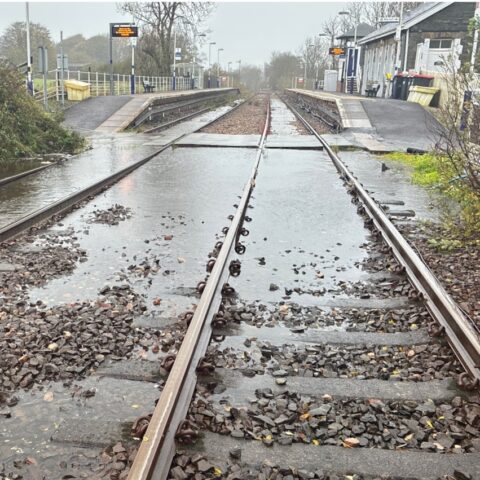

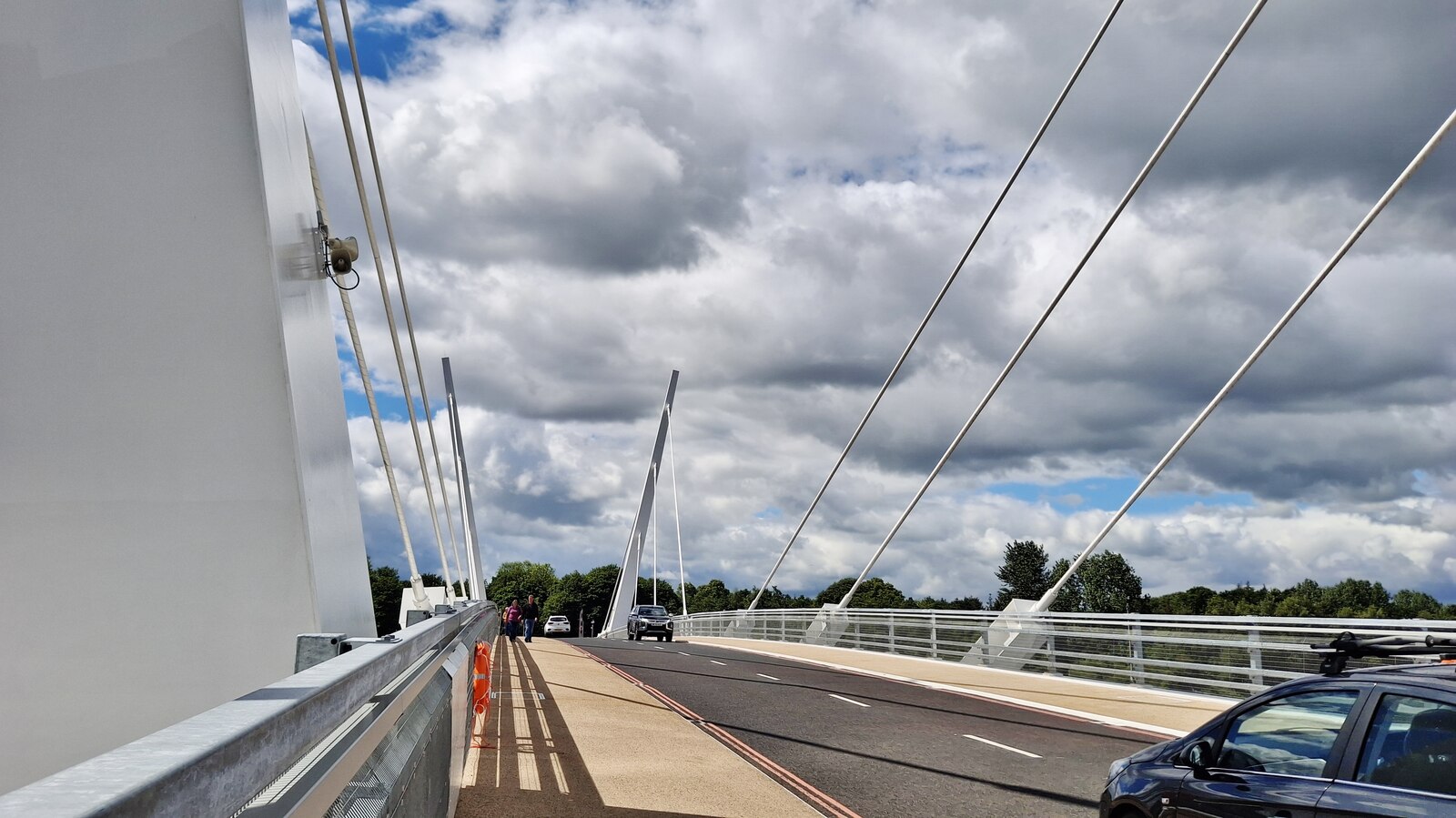
Renfrew Bridge is to remain closed for months after Storm Boelo caused serious water damage to the electrical systems that operate the crossing, less than 18 months after it opened.
The closure was announced from 8pm on Wednesday 28 October, removing the direct crossing between Renfrew and Yoker and Clydebank. Drivers face diversions through the Clyde Tunnel or over the Erskine Bridge, while the bridge’s walking and cycling connection is also unavailable when its two sections are swung open.
Renfrewshire Council said the electronic controls for the hydraulics in the Renfrew-side plant room had suffered significant damage. The operating room on the opposite bank experienced only minimal impact.
Temporary arrangements are being made to open the bridge and leave it in that position so vessels can pass along the Clyde. The council says it has a legal obligation to maintain river access. Those arrangements cannot sustain normal bridge operations.
Gerard Hannah, the council’s head of climate, public protection and roads, apologised to users and said work was under way to establish the circumstances of the damage and restore the crossing.
A Published Requirement to Withstand Tidal Flooding
The council’s own account of the bridge’s design says the solution “needed to remain usable during tidal flooding events”. That requirement was listed alongside maintaining shipping access, avoiding interference with Glasgow Airport’s safeguarding zone and limiting disruption to surrounding communities.
The wording establishes that tidal flooding was a recognised design consideration. It does not, by itself, identify the maximum water level the operating equipment was intended to withstand or establish whether this storm exceeded that level. The immediate engineering questions concern the protection of the plant rooms, how water entered the affected room and why the impacts differed between the two banks.
The council reported a water level of 6.7 metres at Renfrew during the tidal surge on Saturday 24 October, describing it as the highest since digital records began in 1998.
That figure is a reported water level, not a measurement of a 6.7-metre rise above normal conditions. SEPA’s Renfrew tide-gauge information explains that readings are measured against a fixed reference point known as the gauge datum. Its digital record began in March 1998, and the agency treats published measurements as provisional.
The council has also said that activating the North Renfrew flood-management scheme would not have prevented the damage to the bridge plant room, because that scheme protects a different area. The explanation separates the bridge failure from the dispute over the deployment of flood barriers elsewhere in the town.
Part of a £117 Million Waterfront Scheme
The bridge opened to the public on 9 May 2025 as the principal crossing in the Clyde Waterfront and Renfrew Riverside project. The £117 million figure used in the opening announcement covered that wider scheme, including connecting roads and walking and cycling infrastructure. It should not be read as the construction price of the bridge alone.
The 184-metre crossing connects Meadowside Street in Renfrew with Dock Street in Yoker and improves access to Clydebank. It carries two traffic lanes with provision for people walking and cycling. Its two cable-supported sections rotate horizontally to clear the navigation channel for ships.
GRAHAM was appointed as the main contractor in 2021, with responsibility for detailed design, fabrication and construction. The completed bridge brought a new road connection across a stretch of the Clyde previously served by the more distant Clyde Tunnel and Erskine Bridge.
By the time the council marked its first anniversary in May 2026, the crossing was already heavily used. The authority recorded more than 3.5 million crossings between 21 June 2025 and 16 April 2026. Its anniversary statement described improved access to workplaces, hospitals, education, Glasgow Airport and the Advanced Manufacturing Innovation District Scotland.
A Hospital Bus Link Loses Its Crossing
The disruption extends to a public-transport connection introduced only this summer. NHS Greater Glasgow and Clyde announced in July that McGill’s Service 24 would use the bridge to connect Clydebank, Braehead and the Queen Elizabeth University Hospital.
The pilot was scheduled to begin on 13 July, running hourly from Monday to Saturday. The health board promoted the connection as an improvement for patients, visitors and staff. At launch, it warned that temporary bridge openings for ships could prevent buses reaching Clydebank.
A closure lasting months removes the crossing on which that service was designed to depend. Passengers should check McGill’s current service information before travelling, particularly for hospital appointments. A road diversion does not automatically provide an equivalent journey for someone travelling on foot, by bicycle or by bus.
Defects Period and Maintenance Arrangements
Glasgow City Region’s quarterly performance report dated 19 August 2025 records that the project’s completion certificate was dated 18 April 2025. It also states that post-completion monitoring would continue during a two-year contractual defects-liability period.
The storm damage has therefore occurred less than two years after certified completion. Whether it constitutes a contractual defect is a separate question, dependent on the cause of the failure and the relevant contract terms. The existence of that period does not establish that a contractor must meet the repair bill.
A separate public procurement notice records a bridge-maintenance contract awarded to Fairfield Control Systems Ltd, covering planned and reactive maintenance. The published value is £1 million excluding VAT for an anticipated five-year service period beginning on 2 May 2025 and ending on 1 May 2030.
That is the value of a maintenance contract, rather than a published estimate for the storm repairs. The council’s closure announcement does not set out a repair cost, a reopening date or how responsibility for the work will be allocated. Establishing what failed will also be necessary to determine what protection is required before normal operations resume.
Bridge-availability information is published through Renfrewshire Council’s bridge webpage and its official Renfrew Bridge WhatsApp channel.
Sources
Storm damage to temporarily close Renfrew Bridge to road users — Renfrewshire Council. 28 October 2026.
About the Renfrew Bridge — Renfrewshire Council. Undated; accessed 28 October 2026.
Clyde at Renfrew Tide Gauge — Scottish Environment Protection Agency. Live monitoring page; accessed 28 October 2026.
First opening road bridge over the River Clyde set to open in Renfrewshire — Glasgow City Region. 9 May 2025.
Renfrew Bridge marks its one year anniversary — Renfrewshire Council. 27 May 2026.
McGill’s introduces new Renfrew Bridge service to connect QEUH, Clydebank, and Braehead — NHS Greater Glasgow and Clyde. 7 July 2026.
Renfrewshire and East Renfrewshire: timetables and maps — McGill’s Buses. Live service information; accessed 28 October 2026.
Quarterly Performance Report, Q1 2025/26, section 15.14 — Glasgow City Region. 19 August 2025.
Clyde Waterfront and Renfrew Riverside Bridge Maintenance Contract — award notice JUN533403 — Renfrewshire Council / Public Contracts Scotland. 26 June 2025.
Check when Renfrew Bridge is closed to vehicles, pedestrians, and cyclists — Renfrewshire Council. Live service page; accessed 28 October 2026.