
Before GPS, Scotland’s Coast Was a Map Made From Castles, Churches, Chimneys and Hills
In the middle of the nineteenth century, sailors approaching Scotland navigated through a landscape that has largely disappeared from modern experience. Church steeples, ruined castles, coal-pit chimneys, mills, glassworks and distant hills were not merely features of the country seen from the sea. They were working navigational instruments. A newly examined set of sailing directions from 1854 reveals how mariners turned the Scottish coastline into an immense visual map, and how the arrival of lighthouses slowly began to replace it.
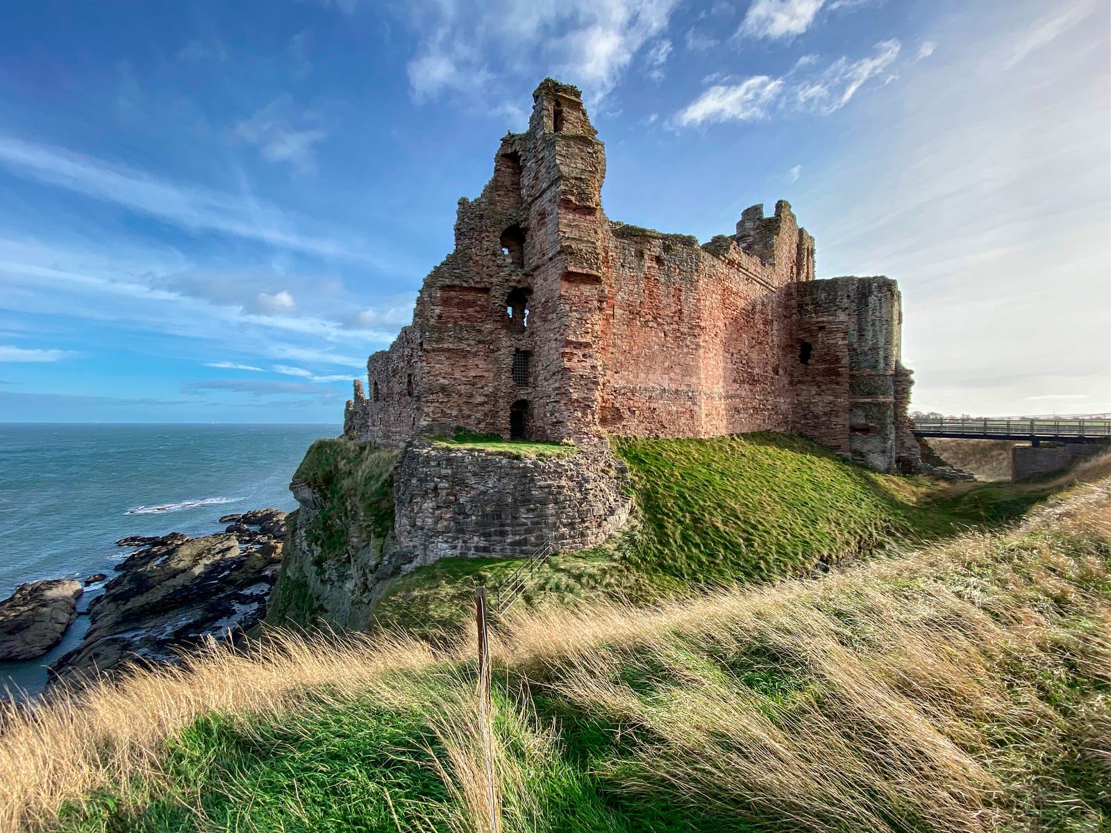
In 1854, a ship approaching the east coast of Scotland might be steered by a ruined castle. Its master could be instructed to keep a church steeple open of a headland, to watch a coal-pit chimney until it aligned with the gable of a house, or to alter course when one distant hill appeared to touch another. The instructions could be extraordinarily precise. A building miles inland might tell a sailor that an invisible reef lay beneath his hull; the apparent movement of two steeples against one another might show that his ship had reached the entrance to a harbour.
This vanished system survives in Sailing Directions for the Navigation of the North Sea, a practical mariner’s manual revised by the hydrographer J. S. Hobbs and published in London in 1854. Drawing on British and continental surveys, it guided ships through the North Sea and devoted extensive attention to Scotland’s eastern coastline. Its pages carry the navigator from St Abb’s Head into the Firth of Forth, around Fife and into the Tay, north past Angus and Aberdeen, around Buchan and the Moray Firth and eventually towards the northern extremities of mainland Scotland.
The book was not intended to preserve history. It was intended to keep ships off rocks. That practical purpose makes its descriptions unusually valuable, because the anonymous churches, houses, industrial structures and natural features recorded in its pages were included only when somebody at sea needed to recognise them. The result is a map of nineteenth-century Scotland organised according to an unfamiliar principle: not political boundaries, roads or property, but visibility.
A country measured from the sea
Coastal navigation before electronic positioning combined several kinds of knowledge. Mariners carried charts and compasses, understood tides and currents, and repeatedly took soundings with the lead. By the nineteenth century they could also rely upon an expanding network of lighthouses, harbour lights, buoys and beacons. Yet the coastline itself remained one of their most important instruments. A conspicuous hill could become visible while the lower land remained below the horizon. Towers and steeples could be recognised above towns. Castles often occupied elevated positions. The industrial revolution added another category of exceptionally useful object: the tall, narrow chimney.
The essential technique was frequently an alignment, or transit. If two fixed objects ashore were known to lie upon a particular bearing, a navigator could watch them until they appeared to stand one behind the other. At that instant the vessel occupied the same line. Other instructions depended upon keeping one object a particular apparent distance to one side of another. The geometry was elementary, but in dangerous coastal waters it could establish a ship’s position with remarkable usefulness.
The Firth of Forth was surrounded by such marks. A vessel approaching from the North Sea could identify the Lomond Hills and Largo Law, whose summits were conspicuous from offshore, together with North Berwick Law, Traprain Law, the Bass Rock and the Isle of May. These familiar features of the modern Scottish landscape belonged to a working maritime geography. Their shapes and their positions relative to one another allowed a navigator to determine which part of the coast he was seeing long before he could identify individual settlements.
The danger off Fife Ness demonstrates why this mattered. The North Carr is a reef extending into the North Sea north-east of the headland, with rocks capable of disappearing beneath the water. The 1854 directions describe it as a particularly dangerous ledge and give several independent methods of avoiding it. Kilminning Craig could be used as one mark. Traprain Law and the Bass Rock supplied another relationship. To clear the reef on another side, a navigator could use the steeples of St Andrews; Crail steeple offered another mark. Medieval and early-modern architecture had consequently become part of the apparatus by which nineteenth-century merchant ships avoided a submerged reef.
The system did not require the objects themselves to have any connection with navigation. It required them to be fixed, recognisable and visible. This produced some remarkable combinations of Scottish landscape and industry.
The coal chimney that marked a hidden rock
Off Dysart, on the Fife coast, lay submerged hazards known as the West Rock Head and East Rock Head. The sailing directions locate the West Rock Head buoy by placing the chimney stack of a Dysart coal pit in line with the middle of the gable of Pan Ha’ House. A second bearing employed part of a Kirkcaldy church and the end of Kirkcaldy pier. Around the East Rock, the navigator could use the ruins of castles at West and East Wemyss, Dysart Church, the town-house steeple and the old mill at Dysart.
It is an extraordinary surviving picture of industrial Scotland viewed from offshore. Fife’s coal workings were transforming the land for reasons entirely unrelated to navigation. Colliery structures were erected to extract and process what lay beneath the ground, but the height of a chimney made it conspicuous at sea. Once mariners discovered that it occupied a useful position relative to another permanent object, the chimney acquired a second function. An industrial structure serving a subterranean industry became an instrument for navigating the surface of the North Sea.
This was not an eccentric local practice. Sailing directions around Britain routinely incorporated windmills, kilns, towers, country houses, churches, industrial buildings and other conspicuous structures. Their architectural importance was immaterial. A modest building standing in exactly the right place could be more valuable to a navigator than a celebrated monument that could not be reliably distinguished from offshore.
The Forth offers perhaps the most striking Scottish example because one of the buildings recruited into this system was Edinburgh Castle. Ships approaching Leith Roads had to negotiate reefs and shoals around Inchkeith and the southern side of the firth. The 1854 instructions describe a sequence of marks involving North Berwick Law, a summer house near Gullane, Inchgarvie, Hound Point, Largo Law, Inchkeith and Cramond. When turning near the Herwit, the navigator could continue until the westernmost glass-house at Leith came nearly into line with Edinburgh Castle.
The castle had accumulated centuries of military and political meaning, but none of that mattered to the sailor watching it from the Forth. Its usefulness came from its position on Castle Rock and its unmistakable place on the skyline. For a vessel entering the waters of the Scottish capital, one of the country’s most important fortresses could become simply one point in a geometric calculation.
When rebuilding a church changed the maritime map
The dependence upon ordinary buildings created an obvious difficulty. Unlike mountains and headlands, buildings could change. A steeple might be rebuilt, a chimney demolished or a new industrial structure erected in front of an older mark. Sailing directions therefore had to record alterations ashore because changes to the skyline could affect people navigating several miles away at sea.
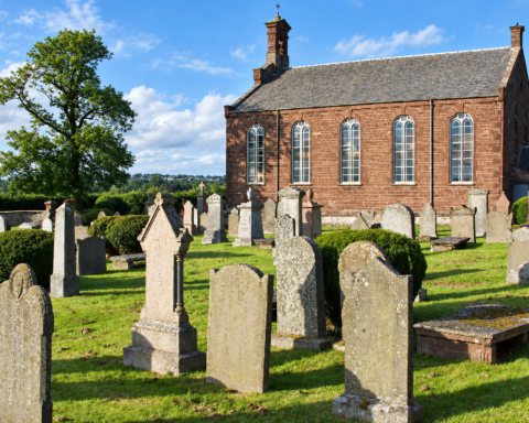
The 1854 directions contain an unusually clear example from Cruden on the Aberdeenshire coast. St James’s Church had recently been rebuilt with a tower and spire approaching 100 feet in height. The book explicitly identifies it as a new landmark. The previous church had long served mariners as a mark, so rebuilding it changed a piece of navigational information that sailors had previously learned and trusted.
A parish church therefore possessed two simultaneous geographies. On land it belonged to its congregation and community. At sea it occupied a bearing. The architect who altered its silhouette was, unintentionally, altering the maritime landscape as well.
The approach to Aberdeen demonstrates how densely populated that landscape could become. Ships entering the harbour had to negotiate the bar at the mouth of the Dee, and the instructions used Old Aberdeen’s church steeples to help establish the vessel’s position. Mariners watched for the point at which the steeples appeared to close behind the end of a broad hill as the vessel crossed the bar. For anchoring in Aberdeen Roads, two of the city’s steeples could again be brought into line.
Aberdeen’s industrial buildings were incorporated too. One approach instructed the navigator to open the northernmost whale-fisher’s boiling house beyond the north pier head and maintain the mark until another part of the harbour became visible. The building existed because Aberdeen participated in the whaling industry. Yet from the deck of an approaching ship, its purpose was temporarily transformed. The place where whale products were processed became part of the mechanism by which another vessel entered the harbour.
Such instructions required navigators to possess an intimate visual knowledge of places they might never visit on foot. A captain could know a church as a shape without knowing its congregation, a castle without knowing its history, or a factory without knowing what happened inside it. Scotland was being learned from the sea as a sequence of silhouettes.
The danger of seeing the wrong Scotland
That system carried a serious weakness: natural landmarks could resemble one another. The sailing directions repeatedly warn mariners against mistaken identity. Between Aberdeen and Buchan Ness, Stirling Hill was sufficiently similar in appearance to Buchan Ness that sailors were known to mistake one for the other. Farther north, Noss Head and Duncansby Head could also appear confusingly alike from the sea. Additional landmarks therefore had to be supplied to establish which headland a vessel was actually approaching.
For a navigator who had been at sea for days, such an error was more than an inconvenience. If a headland had been incorrectly identified, every subsequent course, expected depth and calculation of distance could be based upon a false position. The problem was particularly acute in poor weather, when only fragments of the landscape might appear through haze or rain.
The lead offered one defence against such mistakes. Mariners repeatedly measured the depth beneath the vessel and compared it with the expected soundings. The sailing directions are filled with warnings not to enter water shallower than a stated number of fathoms. Depth therefore operated alongside the visual landscape. If what the eye appeared to show and what the lead reported were inconsistent, the navigator had reason to doubt his position.
Coastal navigation was consequently an act of continuous comparison. The compass supplied direction, the lead supplied depth, the chart supplied the known geography, the tide altered the vessel’s actual movement, and the landscape provided visual confirmation. None was sufficient by itself.
Then Scotland began to build a second coastline
During the late eighteenth and nineteenth centuries, this inherited landscape of natural and accidental marks was increasingly supplemented by structures designed specifically to communicate with ships. The creation and expansion of the Northern Lighthouse Board produced one of the great engineering projects in Scottish history. Robert Stevenson and the generations of Stevenson engineers who followed him constructed lights in places where geography had made navigation particularly dangerous.
By 1854, the sailing directions describe a Scottish coast punctuated by fixed, revolving and coloured lights. Bell Rock had been operating since 1811. Buchan Ness followed in 1827, Cape Wrath in 1828, Girdle Ness at Aberdeen in 1833 and Noss Head in 1849. Harbour authorities added smaller lights to piers and entrances. At night, Scotland was acquiring a new geography made not from the silhouette of the land but from patterns of light.
A lighthouse could provide something a hill never could: an artificial identity. Mariners could be told that a particular light revolved, that another remained fixed, that one appeared red over a certain sector or that flashes recurred at a known interval. The navigator no longer had simply to recognise a shape. He could identify a place by its behaviour in darkness.
Some harbour lights carried information more sophisticated than simple identification. At Aberdeen, lights could indicate dangerous conditions associated with the Dee or the harbour bar. At Arbroath, a small harbour light could be shown when vessels were waiting in the bay and the tide had reached a suitable state for entering. At Leith, coloured lights communicated information associated with water depth and access to the docks. Long before radio communication between harbour and bridge, the shore was already transmitting changing operational information to vessels offshore.
The rock that forced Scotland to engineer the sea
The Bell Rock remains the most powerful example of this transformation. Lying offshore from Angus on the approaches to the Firths of Tay and Forth, the reef is largely submerged at high water and had been feared by mariners for centuries. The 1854 sailing directions describe it as formerly having been considered the most dangerous and fatal rock off the eastern coast of Scotland.
Robert Stevenson’s lighthouse transformed the hazard without removing it. Construction began in 1807, and the light was first exhibited in February 1811. The tower had to be built directly upon a reef that disappeared beneath the North Sea at high tide. Its lower masonry was constructed as an interlocking mass capable of resisting the repeated force of the sea. More than two centuries later, Bell Rock remains operational and is recognised by the Northern Lighthouse Board as the world’s oldest working sea-washed lighthouse.
The engineering achievement is well known, but its effect upon navigation is equally important. Before the lighthouse, the reef had to be understood through charts, soundings, seamarks, experience and the behaviour of the sea. After 1811 it possessed an artificial identity visible at night. The rock had not moved and the water had not become less dangerous. Scotland had simply made the danger communicate its position.
The famous tradition that an Abbot of Arbroath once placed a bell on the reef belongs to the same problem. According to the story, movement of the sea caused the bell to ring and warn passing ships. Stevenson himself investigated the tradition and could find no documentary confirmation in the surviving records of Arbroath Abbey. The story should therefore be treated as tradition rather than established fact. Its persistence nevertheless reflects the problem generations of sailors faced: a lethal object that disappeared beneath the water required some means of announcing itself.
The North Carr acquired another solution. By the middle of the nineteenth century a beacon stood upon the reef. The 1854 directions describe a circular masonry base supporting six cast-iron pillars and terminating in a large ball. Its appearance from a distance was sufficiently unusual that the sailing directions warned that, at certain states of the tide, it could resemble a vessel under sail. Even a structure deliberately constructed as a navigational aid still had to be interpreted correctly by the human eye.
The landscape was never permanent
The old system was constantly becoming obsolete. Chimneys disappeared as industries closed. Churches were enlarged or rebuilt. Castle towers collapsed. Trees grew around once-conspicuous houses. New buildings interrupted old alignments. Harbour extensions changed skylines. A mark printed in one generation’s sailing directions could become useless to the next.
This explains why works such as Norie’s sailing directions were repeatedly revised. The sea itself was dynamic — channels shifted, bars altered and surveys improved — but the supposedly fixed land was changing too. Hobbs’s 1854 edition belongs to this continuing process of correction. It records a Scotland at one particular moment, when old castles and church steeples still coexisted as navigational marks with the products of industrialisation and the new infrastructure of scientific navigation.
The mixture can be seen throughout the book. A navigator might identify a hill formed millions of years ago, steer until a medieval church appeared beside it, use a nineteenth-century coal chimney to clear a rock, check his depth with a lead, pass an iron buoy and then identify his destination from the characteristic flash of a lighthouse. Natural geography, centuries of settlement and the newest engineering technology were all being used simultaneously.
That coexistence is important because the nineteenth century did not suddenly replace traditional seamanship with modern technology. The change was cumulative. Lighthouses did not make hills irrelevant. Buoys did not eliminate the need for soundings. Improved charts did not prevent navigators from using steeples. New systems were laid over older ones, gradually reducing dependence upon the accidental geography of the coast.
During the twentieth century the process accelerated. Radio direction finding, increasingly accurate hydrographic surveys, radar and electronic positioning systems progressively moved navigation away from dependence upon what could be seen ashore. Satellite navigation eventually allowed a vessel to establish its position without recognising a single feature of the country beside it. Electronic charts can now display a ship’s position continuously, while radar can reveal coastlines and structures through darkness and restricted visibility.
Visual navigation has not vanished. Leading lights, headlands, conspicuous buildings and transits remain useful, and professional navigation depends upon checking one source of positional information against another. What has disappeared is the extraordinary density of the relationship between everyday Scottish life and the mariner at sea.
A nineteenth-century captain approaching the Forth was not merely looking towards Scotland. He was measuring it. Edinburgh Castle, a Leith glass-house, North Berwick Law and the buildings around Cramond occupied positions in a practical geometry. Off Fife, coal workings and ruined castles became a warning against underwater rocks. At Aberdeen, church steeples and a whaling works guided vessels towards the Dee. Farther north, the shape of one headland had to be distinguished carefully from another before a course could safely be trusted.
The old sailing directions therefore preserve a historical geography that conventional maps struggle to show. They record which parts of Scotland mattered when the country was viewed horizontally from a moving deck several miles offshore. A famous castle and an obscure chimney could possess equal importance. A church was valuable because of where its steeple appeared against a hill. A house entered the maritime record because its gable happened to stand in precisely the right place.
Many of those relationships have now disappeared. Some of the buildings are gone; others survive but have lost the maritime function they once possessed.
Sources
Sailing Directions for the Navigation of the North Sea — J. W. Norie / J. S. Hobbs — C. Wilson, London — 1854 — https://openlibrary.org/authors/OL2082673A/J._W._Norie
John William Norie Bibliography — Naval Marine Archive — accessed September 2026 — https://navalmarinearchive.com/bibliography/norie.html
Bell Rock — Northern Lighthouse Board — accessed September 2026 — https://www.nlb.org.uk/lighthouses/bell-rock/
Stevenson Engineers — Northern Lighthouse Board — accessed September 2026 — https://www.nlb.org.uk/history/stevenson-engineers/
Lighthouses — Northern Lighthouse Board — accessed September 2026 — https://www.nlb.org.uk/lighthouses/
Our Ships — Northern Lighthouse Board — accessed September 2026 — https://www.nlb.org.uk/history/ships/
Maps of Scotland: Coastal Charts, Admiralty Charts and Ordnance Survey Mapping — National Library of Scotland — accessed September 2026 — https://maps.nls.uk/
New and Extensive Sailing Directions for the Navigation of the North Sea — John William Norie — 1818 — https://play.google.com/store/books/details?id=zkgVAAAAQAAJ